Risan
Risan (Montenegrin: Рисан, ) is a town in the Bay of Kotor, Montenegro. It traces its origins to the ancient settlement of Rhizon, the oldest settlement in the Bay of Kotor.
Lying in the innermost portion of the bay, the settlement was protected from the interior by inaccessible limestone cliffs of the Orjen mountain, the highest range of eastern Adriatic, and through several following narrow straits in the Bay of Kotor from the open sea.
While the Krivošije karst plateau that hangs steep above the narrow shores of Risan bay receives over 5000 mm rain annually (European record), several strong karst springs that form a short brook collect in the narrow cultivable belt at Risan.
It possibly stands in connection with the modern Albanian term "rrahe", meaning "forest clearing".
Map - Risan
Map
Country - Montenegro
 |
 |
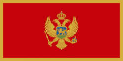
| Flag of Montenegro | |
During the Early Medieval period, three principalities were located on the territory of modern-day Montenegro: Duklja, roughly corresponding to the southern half; Travunia, the west; and Rascia proper, the north. The Principality of Zeta emerged in the 14th and 15th centuries. From the late 14th century to the late 18th century, large parts of southern Montenegro were ruled by the Venetian Republic and incorporated into Venetian Albania. The name Montenegro was first used to refer to the country in the late 15th century. After falling under Ottoman Empire rule, Montenegro gained its semi-autonomy in 1696 under the rule of the House of Petrović-Njegoš, first as a theocracy and later as a secular principality. Montenegro's independence was recognised by the Great Powers at the Congress of Berlin in 1878. In 1910, the country became a kingdom.
Currency / Language
| ISO | Currency | Symbol | Significant figures |
|---|---|---|---|
| EUR | Euro | € | 2 |
| ISO | Language |
|---|---|
| SQ | Albanian language |
| BS | Bosnian language |
| HR | Croatian language |
| HU | Hungarian language |
| SR | Serbian language |


